Direct link to this page: www.au.dk/OML-Highway
|
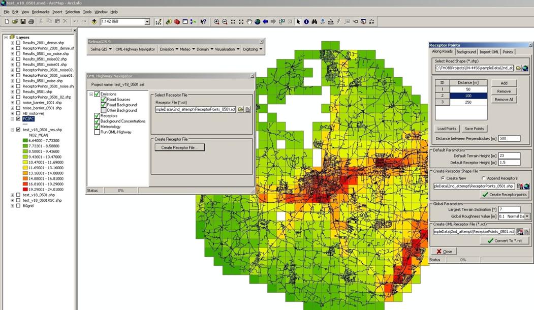
OML-Highway is a user-friendly GIS-based model for assessment of air quality along motorways and other main roads in open terrain. OML-Highway is an extension for ESRI® ArcGIS. |
The OML-Highway model is a user-friendly GIS-based model for assessment of air quality along motorways and other main roads in open terrain. It is a local-scale Gaussian air pollution model based on modern boundary layer scaling. In the OML-Highway model road sources are approximated as area sources and the influence of traffic induced turbulence is included. For a further description of model characteristics, input-output, validation etc. go to OML-Highway description and references. Intended model applications and examples of practical applications are given in OML-Highway model applications.
The OML-Highway model has been developed by the Department of Environmental Science (ENVS), Aarhus University and has been integrated into the GIS environment SELMAGIS in co-operation with Lohmeyer GmbH & Co. KG. The OML-Highway model runs as an extension to ArcGIS. The interface is described in a user manual.