Basemap is a national map of land use and land cover for Denmark. Basemap combines publicly available spatial information into one map. Basemap is a raster map with a cell size of 10 x 10 meter. The first version of Basemap was created in 2011. In 2017, DCE-Aarhus University compiled an updated version for Statistics Denmark based on input data for the year 2016 (Basemap02) and in 2019, DCE-Aarhus University compiled an updated version for Statistics Denmark, based on input data for the year 2018 (Basemap03). Basemap is the most up to date national map of land use and land cover and is being used by a variety of researchers, public agencies and private companies.
Statistics Denmark uses Basemap for the green national accounts for Denmark and for Danish land use statistics. The strength of Basemap is a documented and transparent method. Furthermore, original land use categories of input data are kept, allowing users to aggregate classes according to specific needs.
The technical documentation of Basemap02 can be found here
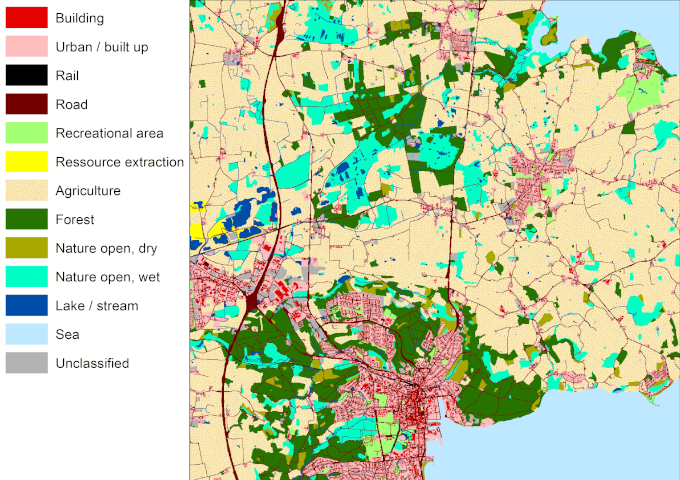
An aggregated version of Basemap02 for 2016 can be seen here
The map can be downloaded in a geodatabase here
The technical documentation of Basemap03 can be found here
An aggregated version of Basemap03 for 2018 can be seen here
The map can be downloaded in a geodatabase here
The map can be downloaded as geotiff here
The technical documentation of Basemao04 can be found here
An aggregated vesion of Basemap04 for 2021 can be seen here
The map can be downloaded in a geodatabase here
The map can be downloaded as geotiff here

