
Update of Basemap granted by Statistics Denmark
A new, up-to-date version of Basemap, will be applied in the national accounting.
Gregor Levin, Senior Advisor, has received a grant from Statistics Denmark on 253,000 DKK for making an updated version of Basemap.
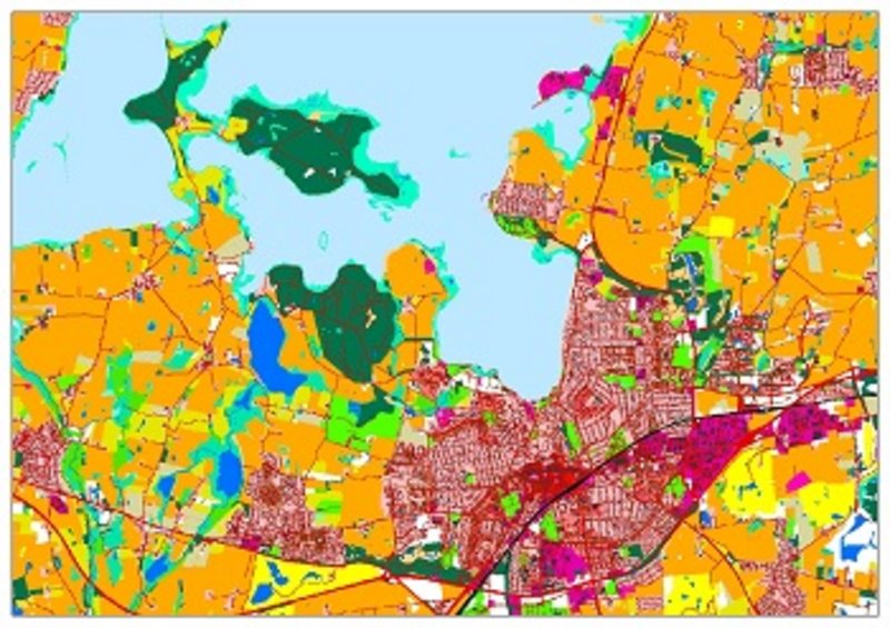
Basemap is a full-coverage map of land use and land cover for Denmark. Basemap is based on a combination of different types of accessible geographical information, containing information on land use and land cover.
This information includes topographic maps, cadaster maps, field parcels maps and maps from administration and monitoring of nature. The first version of Basemap from 2011 is widely applied by scientists, stakeholders and private companies.
The new, up-to-date version of Basemap, will be applied in the national accounting.
For further information please contact Gregor Levin at gl@envs.au.dk.